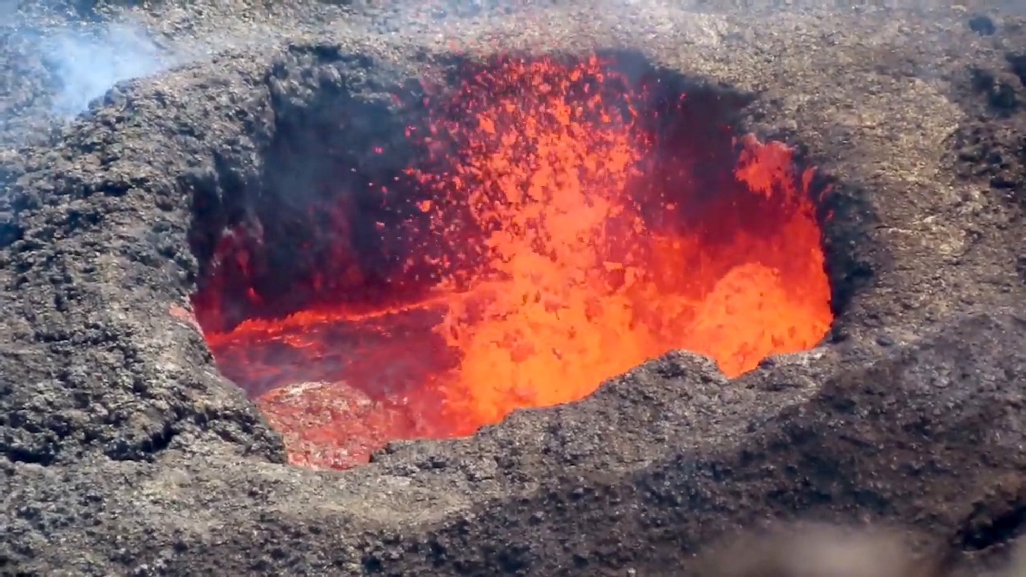
Hawaii’s Kīlauea volcano has been erupting since Sept. 29, and the latest video from the U.S. Geological Survey shows lava sloshing in the crater, still roiling and spilling over the edge nearly two months later.
A Nov. 18 report by the U.S. Geological Survey said lava activity is currently confined within the Halemaʻumaʻu pit crater, located within the Kīlauea Caldera. Footage shows the orange lava bubbling and pouring over the edge during an ongoing volcanic burst.
Commenting on both videos, the U.S. Geological Survey wrote: “Lava continues to erupt from the west vent in Halemaʻumaʻu and supply the lava lake through a spillway in the spatter cone.
“On Nov. 9, a close-up view of the west vent shows spatter bursting and sloshing within the cone. Spatter was thrown about 6 meters to 9 meters [20 feet to 30 feet] above the pond surface, occasionally depositing spatter onto the rim of the cone.”
The agency said of the second video: “On November 12, a small overflow of the perched lava lake levee was visible from the western crater rim.
“Overflows are an important process for building up perched levees, as they help add height and stability. The height of the levee in this video was measured at 1 meter [3.3 feet].”

As of Nov. 18, the agency wrote that seismic activity and gas emissions at the summit remained elevated.
The U.S. Geological Survey also reported the eruption was being monitored from “within the closed area of Hawaii‘i Volcanoes National Park” by Hawaiian Volcano Observatory field crews equipped with specialized safety gear.
The scientific agency hopes the detailed data collected by scientists will allow them to assess hazards and understand how the ongoing eruption at Kīlauea is evolving.
The scientists are sharing all information with emergency managers and the National Park Service.

Believed to be between 210,000 and 280,000 years old, the Kīlauea volcano emerged from the sea about 100,000 years ago. Kīlauea is located on Hawai’i, the official name of the largest island in the archipelago, also called the Big Island. (It’s not to be confused with Hawaii, the state.)
The Hawai’i island consists of five volcanoes, four of which are classified as active: Kīlauea, Mauna, Mauna Loa, Hualālai and Mauna Kea. Kīlauea is historically the most active.
The U.S. Geological Survey ranked it first among volcanoes in the U.S. in 2018 that was most likely to threaten lives and infrastructure.
Kīlauea’s last major eruption took place between May and September 2018 and led to thousands of local residents being displaced and the destruction of 716 homes. Previous eruptions have caused widespread damage, including the destruction of the towns of Kalapana and Kaimū in 1990.
Edited by Fern Siegel and Kristen Butler
The post VIDEO: Boiling Over: Lava Still Spilling In Hawaii’s 2-Month Eruption appeared first on Zenger News.


